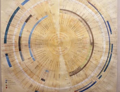
A drawing to explore the wider context of the Alkborough Flats Tidal Defence Scheme
The Humber Estuary from South Ferriby to Burton Stather, a drawing to explore the wider context of the Alkborough Flats, Tidal Defence Scheme.
In 2012 I was commissioned by the Arts and Humanities Research Council Landscape and Environment Programme to produce a drawing/map of Alkborough Flats in North Lincolnshire. The brief was to make a clear discursive connection to Mike Pearsons soundwork “Warplands” based on the same site also commissioned by AHRC. Each mapwork that I have undertaken over recent years has been with a very specific purpose in mind and this was usually to gain an insight into the dynamic of the natural systems at work, be they coastal or estuarine and the strategic approach to their management. Initially generated as a means of grounding myself in the discussion, I quickly realized that these works also could be a valuable tool in discussing change and management in a community context.
I started these works with a view that if, using a pictorial language, one can focus the essence of an enquiry on to a single sheet of paper, this could foster a spirit of reflection that might help stakeholders address issues on a better informed basis. I quickly realized in the process of making these drawings that I was engaging a methodology that was an equivalent to the processes described, the pictorial language started to work in a parallel way. Particularly in the use of watercolour on paper flow, permeability, porosity, liminality are values that are shared with watery environments. Armed with this I can see now that the works have acquired another dimension where the behaviour of medium is an active part of the contemplative process and lends the discussion another level of immediacy that would not be possible if treated just as information.
When I was invited to make this work, I started from a position of ignorance of the site itself but with an awareness of the range of processes that it would be subject to. As a consequence I decided that I would explore the conditions that drove the decision to realign the Alkborough Flats by mapping the wider context. Since this exercise is more disinterested than the projects carried out on the Suffolk Coast where I have a specific community role, I felt free to explore further the integrity of the drawing process in relation to the enquiry. As a result of this I could understand from a detached point of view, the dilemma of Flood Risk Management in an estuarine environment that is populous, highly industrialised and agriculturally extremely productive.
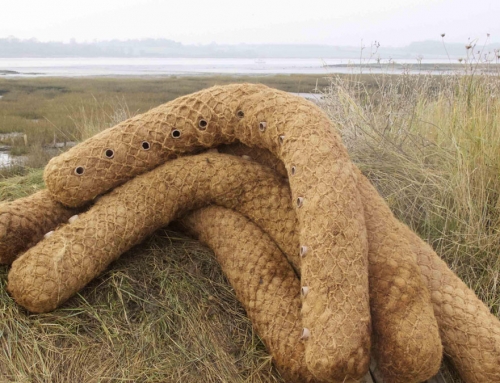
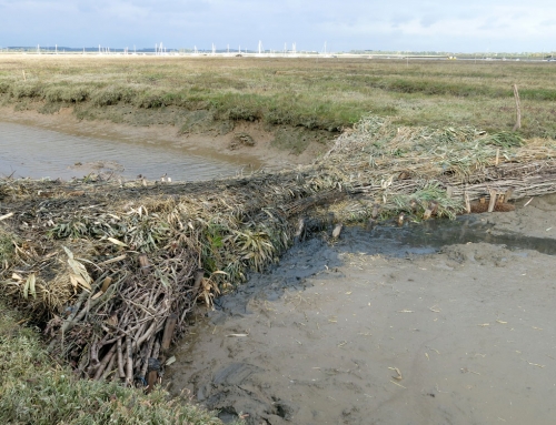
[justified_image_grid ids=1652,1653,1654,1655,1656 row_height=180]
Extract from an email to Mike Pearson 23rd July 2012
Hi Mike,
Attached is an image of the drawing for Steve, just about complete. I have discovered some interesting facts about the site, purely about the nature of its reclamation and its letting go. Both were probably done because they could be:
The site is a ‘ness’ and as such would have built itself up through gradual accretion where the sediment would have rolled back on its outer edge to automatically create higher land on the outside than the inside. The inside could be the same level as when it started with a rampart of sediment being thrown up in front or else, like a lot of reclaimed land it could have shrunk and dropped in level as a result of drainage. As a consequence, it is the inside that floods most readily on the tide. The levels in the site are on average a good metre or more higher that those on the other side of the Trent around Adingfleet etc. As a consequence it doesn’t offer a great deal of scope for flood storage, but it does (for the time-being) for habitat creation. I say “for the time being” because essentially it is it is not vulnerable and will only accrete more silt especially at the back of the site where it is at its lowest and the tide gets to most frequently. Unlike other more vulnerable sites in the estuary, the building of a wall would probably not have been a reclamation so much as consolidation of what was already there.
It is ideal for the creation of salt habitat; the site is penned in at top and bottom by the chalk escarpment and only needs attention to its extreme ends to contain it. It will not fill to a great depth so will never get out of control and burst out since the land rises towards the river, this gradient that just gradually becomes steeper at the wall. Even the breach cannot be lower than 2.8 metres OAD because given the levels inside the site this would not make sense hydraulically.
I can see the thinking, situated where it is at quite a narrow river entrance at Trent Falls and there being only one farmer to compensate, but find it compelling that the driver for this project could be as much the European Habitats Directive as flood risk management. Especially since within half a century, the back of the site will have become very nicely recharged with silt thank you and so long as it is not thoroughly awash through sea level rise, it will be nice alluvial stuff that once remediated will eventually make productive farmland again.
However, not to be totally cynical, I saw the most humungous flock of Avocet there fast asleep on the mud, we usually wet ourselves with excitement when we see a dozen around here.
All the best,
Simon