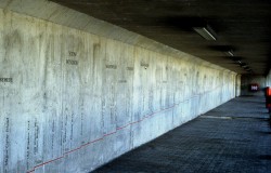
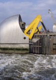
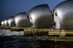
The Thames Profile was commissioned by the Countryside Commission to mark the beginning of the Thames Path at the Thames Flood Barrier. The site is a concrete wall 80 by 2.30 metres in the gallery formed by the path where it passes alongside the Barrier beneath the working area.
Prior to this I had carried out an artist in residency for the Countryside Agency upon the Upper Thames and had become interested in the need for strenuous flood control measures in that flood plain otherwise known as the Thames Valley. When it came to visualising the river I saw the language of hydrology to be most appropriate, particularly in view of the location of the work, the quintessence of control of level.
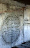
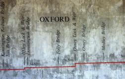
The work is a longitudinal section of the river designed to fit the wall exactly. It is to scale and plots the fall of the river above head height to the sea around the ankles. It is seen as a red line cut into the concrete with information relating only to the river’s topography included as incised text; heights above sea level at weir points, tributaries, settlements, crossings.
The intention is that this has potential to make as much sense in an educational context as to heighten the awareness that the river is a line, a path encompassing a great variety of landscape; which once started continues uninterrupted for 210 miles into the heart of the English countryside.